In Houston, there are only three topographic features: the bayous, the freeways, and the skyscrapers. The concept of a natural vantage point from which you can view the city—like the infamous view of Los Angeles from the Santa Monica Mountains—was largely foreign to me as a kid. I’d only catch brief glimpses of the broader cityscape when ascending one of the region’s stacked interchanges.
When I moved to St. Louis, I was pleasantly surprised by the city’s hilliness. While it’s probably about average for an American city (and not even the most interesting in Missouri), it’s far more than nothing. There’s a noticable variation in elevation within the city proper, and the northern reaches of the Ozarks buttress the suburban sprawl of South County, providing a rugged backcountry for hiking and nature-admiring. On my habitual weekend excursions on foot and bike, I’ve gained a greater appreciation for how the city’s crests and valleys accentuate the experience of exploring the city.
Art Hill is probably the most iconic vantage point in St. Louis, offering a beautiful view across the historic Grand Basin toward North City. The infamous slope is quite prominent, rising fifty feet above the water. However, despite Google’s incorrect assertion, Art Hill is not the highest point in St. Louis—that distinction goes to Sublette Park in Southwest Garden, which is the crest of the large hill that gives “The Hill” its name.
There is no plaque or sign marking Sublette Park as the highest point in the city, but there are plenty of nearby indications that “The Hill” is really quite high up there. Most prominent is the (name), the massive Romanesque building that once housed the city’s Insane Asylum. The building’s cast-iron dome, visible from up to thirty miles away, towers over the otherwise low-slung cityscape of South City. If you meander around The Hill from there, you’ll catch a few glimpses of the surrounding landscape. Heading east on Southwest Avenue from Macklind presents an exciting view of the Arch and Downtown, framed by the enthusiastic Italian branding of Southwest Auto Parts and Columbia Auto Repair. At certain points—such as around the Shaw School, or further west at the intersection of Southwest and Watson—one can see the skyline of the Central West End to the north, with the jagged silhouette of the One Hundred standing out.

The northern edge of The Hill is probably the best reminder that it is indeed a hill. There’s a steep dropoff from the neighborhood down to the River Des Peres and its surrounding valley, which is most noticable heading north on Macklind toward Manchester. The industrial lowlands around the river and two railroad mainlines (Union Pacific’s Jefferson City Subidivison and BNSF’s DeSoto Subdivision) are a world away from the cohesive urbanity of South City—perhaps this geographic rift is really what separates the Central Corridor from points south.
This “valley” extends east to Downtown and the Mississippi and is perhaps the defining geographic feature of St. Louis. Much of the city’s Central Corridor—the densest neighborhoods—straddle this relatively low land, creating ample opportunities to capture panoramic views from surrounding high points. While The Hill is the tallest of these spots, it’s far from the only location in the city that offers a vantage point for viewing Downtown.
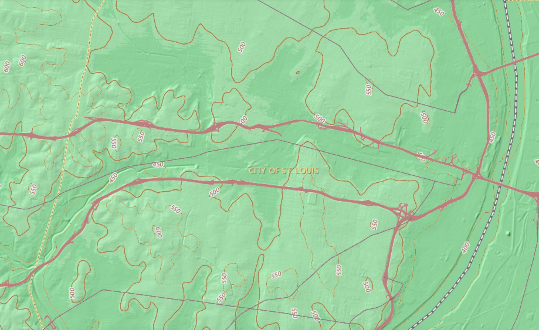
The southern ridge of the valley sits between Interstates 44 and 64, extending east from the dramatic slope on Macklind. The valley is more noticable in some areas than others—for example, around Forest Park Southeast, it widens into a broad, shallow bowl, its slopes too gentle to produce vantage points. However, as one approaches Grand Boulevard to the east, Compton Hill lifts the terrain, crowned by the iconic Compton Hill Reservoir and water tower. The hill is the most noticable feature of a broader plateau encompassing much of South City.
It’s at the northwestern corner of Compton Hill—directly north of the reservoir, underneath the sprawling SSM Health–St. Louis University campus—that we find the city’s best vantage point. The hill rises up to 90 feet above the valley to the west, north, and east, forming a narrow peninsula with unparalleled visibility in both directions. Most St. Louisans will recognize this high ground as the location of the intersection of Grand and Chouteau, flanked by two large vacant parcels of land controlled by SLU.
The primary buildings of the SSM Health–St. Louis Univeristy Hospital offer the best view of the city from Compton Hill. Among the three largest buildings, the old and new wings of the hospital and the distinctive Doisy Research Center, the latter provides the broadest panorama of the city, sited further north and away from the core of the hospital complex. User images from Google Maps show the view from the upper floors, though none capture Downtown itself.


Of course, the Research Center is only open to people who have business there—so what’s the best publicly accessible view from Compton Hill? The most likely answer is the large, recently-constructed SLU Hospital parking garage, also sited at the north end of the hill, directly west of the Research Center. Like most parking garages, it appears one can simply walk in and take the stairs to the top deck—something I’ve hesitated to try given the likely presence of security at such a busy garage.
A more relaxed alternative can be found about 1,400 feet to the west: the Hickory East Garage serving SLU’s small southern campus. Sitting at an elevation of 500 feet, this garage isn’t quite as prominent as the main SLU Hospital garage, but it still offers unobstructed views to the the north and west. I took a quick bike ride out to the garage on a chilly, gray Sunday a couple of weeks ago and found it almost entirely empty. I locked my bike to a street sign, entered the garage’s southeast corner, took the stairs to the top, and captured this wonderful view of Downtown:

I’m excited to discover what other unique vantage points and topographic quirks are hidden throughout St. Louis. It’s not Los Angeles, Denver, or even Cincinnati, but St. Louis’s hills and valleys can still produce exciting visual moments and distinct urban environments. It’s impossible to understand any city without appreciating its geography—after all, the settlement of St. Louis was only possible because it sits on bluffs rising above the Mississippi, shielded from the river’s calamatous floods. The terrain defines the city, and, over time, the city comes to define the terrain. What that tug-of-war produces is something to behold.